


Garmin GPSMAP H1 – Premium GPS Handheld Touchscreen
The Garmin GPSMAP H1 is a tough, reliable handheld GPS designed for outdoor recreation, trekking, and exploration. Built with advanced satellite support and long battery life, it ensures accurate navigation even in the most challenging environments.
Status Barang: Preorder (3)
Kondisi: Baru
Minimal Order: 1 pcs
OVERVIEW:
The Garmin GPSMAP H1 is a rugged, handheld GPS navigator designed for serious outdoor use — from hiking and trekking to expeditions and remote-area navigation. It combines robust hardware, precise positioning, long battery life, and versatile mapping features to help you navigate almost anywhere on Earth.
SPECIFICATION:
General
LENS MATERIAL: chemically strengthened glass
WATER RATING: IP67
MIL-STD-810: yes (thermal, shock, water); bare unit only
◆ TOUCHSCREEN
◆ DISPLAY TYPE: transflective color TFT
◆ DISPLAY SIZE: 1.9″W x 3.0″H (4.7 x 7.7 cm), 3.5″ diagonal (8.9 cm)
◆ DISPLAY RESOLUTION: 282 x 470 pixels
◆ BATTERY TYPE: rechargeable, internal lithium-ion
◆ MEMORY/HISTORY: 64 GB (user space varies based on included mapping)
◆ INTERFACE: USB-C
Maps & Memory
◆ PRELOADED MAPS: yes (TopoActive, routable)
◆ ABILITY TO ADD MAPS
◆ BASEMAP
◆ AUTOMATIC ROUTING (TURN BY TURN ROUTING ON ROADS) FOR OUTDOOR ACTIVITIES
◆ MAP SEGMENTS: yes (15,000)
◆ SATELLITE IMAGERY: yes (direct to device)
◆ EXTERNAL MEMORY STORAGE: yes (1 TB max microSD card)
◆ WAYPOINTS
◆ COURSES: unlimited
◆ ACTIVITIES: unlimited
◆ ACTIVITY PROFILES
◆ GPX IMPORTS
◆ RINEX LOGGING
Sensors
◆ GPS
◆ GALILEO
◆ QZSS
◆ BEIDOU
◆ IRNSS
◆ BAROMETRIC ALTIMETER
◆ COMPASS
◆ HIGH-SENSITIVITY RECEIVER
◆ GPS COMPASS (WHILE MOVING)
◆ MULTI-BAND FREQUENCY SUPPORT
Daily Smart Features
◆ CONNECT IQ (DOWNLOADABLE WATCH FACES, DATA FIELDS AND APPS)
◆ SMART NOTIFICATIONS ON HANDHELD
◆ WEATHER
◆ PAIRS WITH GARMIN CONNECT MOBILE
◆ GARMIN SHARE
◆ PASSCODE
◆ NEXT WORD, AUTO COMPLETE, AUTO CORRECT: yes (Auto Correct, Next Word, Auto Complete)
Safety and Tracking Features
◆ LIVETRACK
◆ SAFETY SIREN
Tactical Features
◆ COMPATIBLE WITH AB QUANTUM – GARMIN
◆ BALLISTICS SOLVER: yes (unlock required)
◆ DUAL GRID COORDINATES
◆ NIGHT VISION MODE
Outdoor Recreation
◆ POINT-TO-POINT NAVIGATION
◆ SPOKEN TURN-BY-TURN DIRECTIONS
◆ TRACBACK
◆ AREA CALCULATION
◆ SUN AND MOON INFORMATION
◆ GEOCACHING-FRIENDLY: yes (Geocache Live)
◆ CUSTOM MAPS COMPATIBLE: yes (500 custom map tiles)
◆ PICTURE VIEWER
◆ INREACH REMOTE WIDGET
◆ LED BEACON FLASHLIGHT
◆ FLASHLIGHT
Outdoor Applications
◆ COMPATIBLE WITH GARMIN EXPLORE APP
◆ GARMIN EXPLORE WEBSITE COMPATIBLE
◆ DOG TRACKING: yes (when paired to compatible dog track system)
Connections
◆ WIRELESS CONNECTIVITY: yes (Wi-Fi, BLE, ANT+)
EACH UNIT INCLUDES WITH:
◆ GPSMAP H1
◆ Loop Carabiner
◆ Charging/Data Cable
◆ Documentation
| Berat | 1 kg |
|---|
General |
|
| Lens Material | chemically strengthened glass |
|---|---|
| Dimension | 2.6″ x 7.0″ x 1.3″ (6.7 cm x 17.9 cm x 3.3cm) |
| Weight | 9.7 oz (276 g) |
| Water rating | IP67 |
| MIL-STD-810 | yes (thermal, shock, water); bare unit only |
| Touchscreen | ✅ |
| Display Type | transflective color TFT |
| Display Size | 1.9″W x 3.0″H (4.7 x 7.7 cm), 3.5″ diagonal (8.9 cm) |
| Display resolution | 282 x 470 pixels |
| Battery Type | rechargeable, internal lithium-ion |
| Battery life | All Satellite Systems + Multi-band: Up to 145 hours* Expedition mode: Up to 840 hours *Assuming typical use with SatIQ™ technology |
| Memory/History | 64 GB (user space varies based on included mapping) |
| Interface | USB-C |
Maps & Memory |
|
| Preloaded maps | yes (TopoActive, routable) |
|---|---|
| Ability to add maps | ✅ |
| Basemap | ✅ |
| Automatic routing (turn by turn routing on roads) for outdoor activities | ✅ |
| Map segments | yes (15,000) |
| Satellite Imagery | yes (direct to device) |
| Includes detailed hydrographic features (coastlines, lake/river shorelines, wetlands and perennial and seasonal streams) | ✅ |
| Includes searchable points of interests (parks, campgrounds, scenic lookouts and picnic sites) | ✅ |
| Displays national, state and local parks, forests, and wilderness areas | ✅ |
| External memory storage | yes (1 TB max microSD card) |
| Waypoints | ✅ |
| Courses | unlimited |
| Activities | unlimited |
| Activity profiles | ✅ |
| GPX imports | ✅ |
| Rinex logging | ✅ |
Sensors |
|
| GPS | ✅ |
|---|---|
| Galileo | ✅ |
| QZSS | ✅ |
| BeiDou | ✅ |
| IRNSS | ✅ |
| Barometric altimeter | ✅ |
| Compass | ✅ |
| High-sensitivity receiver | ✅ |
| GPS compass (while moving) | ✅ |
| Multi-band frequency support | ✅ |
Daily Smart Features |
|
| Connect IQ™ (downloadable watch faces, data fields and apps) | ✅ |
|---|---|
| Smart notifications on handheld | ✅ |
| Weather | ✅ |
| Pairs with Garmin Connect™ Mobile | ✅ |
| Garmin Share | ✅ |
| Passcode | ✅ |
| Next Word, Auto Complete, Auto Correct | yes (Auto Correct, Next Word, Auto Complete) |
Safety and Tracking Features |
|
| LiveTrack | ✅ |
|---|---|
| Safety siren | ✅ |
Tactical Features |
|
| Compatible with AB Quantum – Garmin | ✅ |
|---|---|
| Ballistics solver | yes (unlock required) |
| Dual grid coordinates | ✅ |
| Night vision mode | ✅ |
Outdoor Recreation |
|
| Point-to-point navigation | ✅ |
|---|---|
| Spoken turn-by-turn directions | ✅ |
| TracBack® | ✅ |
| Area calculation | ✅ |
| Sun and moon information | ✅ |
| Geocaching-friendly | yes (Geocache Live) |
| Custom maps compatible | yes (500 custom map tiles) |
| Picture viewer | ✅ |
| inReach remote widget | ✅ |
| LED beacon flashlight | ✅ |
| Flashlight | ✅ |
inReach® Features |
|
| inReach remote compatible | ✅ |
|---|---|
Outdoor Applications |
|
| Compatible with Garmin Explore™ app | ✅ |
|---|---|
| Garmin Explore website compatible | ✅ |
| Dog tracking | yes (when paired to compatible dog track system) |
Connections |
|
| Wireless Connectivity | yes (Wi-Fi®, BLE, ANT+®) |
|---|---|
Based on 0 reviews
Be the first to review “Garmin GPSMAP H1 – Premium GPS Handheld Touchscreen”
Produk Terkait
-
Ready Stock
-
Ready StockHandheld GPS
Garmin GPSMAP 65s – Multi-Band GPS Handheld with Sensors
The Garmin GPSMAP 65s is a rugged handheld GPS built for hikers, explorers, and outdoor enthusiasts who demand accuracy and reliability in challenging environments. With advanced multi-band GNSS support, preloaded maps, and ABC sensors, it ensures you stay on track wherever your adventure takes you.
SKU: 010-02451-15 -
Ready StockHandheld GPS
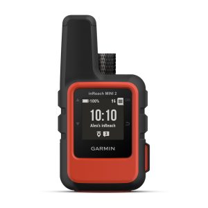
Garmin inReach Mini 2 Flame Red – Compact Satellite Communicator (NON TAM)
The Garmin inReach Mini 2 is a rugged, palm-sized satellite communicator that keeps you connected wherever your adventures take you. Whether hiking, sailing, or exploring remote areas, it provides peace of mind with global coverage, SOS alerts, and two-way messaging—all in a lightweight design.
SKU: 010-02602-20 -
Pre-OrderHandheld GPS
Garmin GPSMAP H1i Plus – Premium GPS Handheld with inReach Plus Satellite Technology
The Garmin GPSMAP H1i Plus is Garmin’s latest rugged handheld GPS with built‑in inReach satellite communication, combining advanced navigation, global messaging, and SOS safety features. It offers a hybrid touchscreen + button design, preloaded maps, satellite imagery, and up to 145 hours of battery life.
SKU: 010-02921-11


There are no reviews yet.