


Garmin GPSMAP 79s – Marine Handheld with Worldwide Basemap
5 in stock
The Garmin GPSMAP® 79s is a rugged handheld marine GPS designed for boating and sailing, featuring a floatable waterproof design, built-in compass
Status Barang: Ready
Kondisi: Baru
$323.30
5 in stock
Gamin GPSMAP 79s
Marine Handheld with Worldwide Basemap
OVERVIEW:
The GPSMAP 79s with a built-in worldwide basemap and support for downloadable marine charts. In addition to a 3-axis tilt-compensated compass, GPSMAP 79 marine handhelds use reliable GNSS with support for multiple constellations which allows boaters to access data across the world.
FEATURES:
◆ Rugged Handheld
◆ Designed to Float
◆ Accurate Tracking
◆ Increased Memory
◆ Built-In Compass
SPEC’s:
General
◆ Display resolution: 240 x 400 pixels
◆ Display Type: transflective, 65K color TFT
◆ Battery type: 2 AA batteries (not included); NiMH or Lithium recommended
◆ Battery life: up to 19 hours
◆ Waterproof: IPX7
◆ MIL-STD-810: Yes (thermal, shock, water); bare unit only
◆ Interface: high speed micro-USB and NMEA 0183 compatible
◆ Internal Memory: 8 GB
Maps & Memory
◆ Ability to add maps
◆ Basemap
◆ Map segments: 15000
◆ External memory storage: Yes (32 GB max microSD card, not included)
◆ Waypoints/favorites/locations: 10000
◆ Tracks: 250
◆ Navigation Track Log: 20,000 points, 250 saved gpx tracks, 300 saved fit activities
◆ Navigation Routes: 250, 250 points per route; 50 points auto routing
◆ Rinex logging
Sensors
◆ High-sensitivity receiver
◆ GPS
◆ GLONASS
◆ Galileo
◆ QZSS
◆ SBAS
◆ Compass: Yes (tilt-compensated 3-axis)
◆ GPS compass (while moving)
Outdoor Recreation
◆ Point-to-point navigation
◆ Area calculation
◆ Hunt/fish calendar
◆ Geocaching-friendly: Yes (Paperless)
◆ Custom maps compatible
◆ Picture viewer
EACH UNIT INCLUDES WITH:
◆ GPSMAP 79s
◆ Lanyard
◆ USB cable
◆ Documentation
| Weight | 1 kg |
|---|
General |
|
| Lens Material | chemically strengthened glass |
|---|---|
| Dimension | 2.67” x 6.85” x 1.67” (6.77 x 17.40 x 4.23 cm) |
| Weight | 9.95 oz (282g) with batteries |
| Water rating | IPX7 |
| MIL-STD-810 | yes (thermal, shock, water); bare unit only |
| Display Type | transflective, 65K color TFT |
| Display Size | 1.5″W x 2.5″H (3.8 x 6.3 cm); 3″ diag (7.6 cm) |
| Display resolution | 240 x 400 pixels |
| Battery Type | 2 AA batteries (not included); NiMH or Lithium recommended |
| Battery life | up to 19 hours |
| Memory/History | 8 GB (user space varies based on included mapping on sc version) |
| Interface | high speed microUSB and NMEA 0183 compatible |
Maps & Memory |
|
| Preloaded maps | Available on sc version only |
|---|---|
| Ability to add maps | ✅ |
| Basemap | ✅ |
| Automatic routing (turn by turn routing on roads) for outdoor activities | Yes (with optional mapping for detailed roads) |
| Map segments | 15,000 |
| Includes detailed hydrographic features (coastlines, lake/river shorelines, wetlands and perennial and seasonal streams) | Yes (downloadable from Garmin Express™) |
| Includes searchable points of interests (parks, campgrounds, scenic lookouts and picnic sites) | Yes (downloadable from Garmin Express™) |
| Displays national, state and local parks, forests, and wilderness areas | Yes (downloadable from Garmin Express™) |
| External memory storage | yes (32 GB max microSD™ card) |
| Waypoints/favorites/locations | 10,000 |
| Courses | 250, 200 course points per course |
| Tracks | 250 |
| Navigation Track Log | 20,000 points, 250 saved gpx tracks, 300 saved fit activities |
| Navigation Routes | 250, 250 points per route; 50 points auto routing |
| Rinex logging | ✅ |
Sensors |
|
| GPS | ✅ |
|---|---|
| Galileo | ✅ |
| QZSS | ✅ |
| SBAS | ✅ |
| Compass | Yes (tilt-compensated 3-axis) |
| High-sensitivity receiver | ✅ |
| GPS compass (while moving) | ✅ |
Outdoor Recreation |
|
| Point-to-point navigation | ✅ |
|---|---|
| Area calculation | ✅ |
| Fish forecast | ✅ |
| Geocaching-friendly | Yes (Paperless) |
| Custom maps compatible | ✅ |
| Picture viewer | ✅ |
Based on 0 reviews
Be the first to review “Garmin GPSMAP 79s – Marine Handheld with Worldwide Basemap”
Related products
-
Ready StockHandheld GPS
Garmin GPSMAP 65s – Multi-Band GPS Handheld with Sensors
The Garmin GPSMAP 65s is a rugged handheld GPS built for hikers, explorers, and outdoor enthusiasts who demand accuracy and reliability in challenging environments. With advanced multi-band GNSS support, preloaded maps, and ABC sensors, it ensures you stay on track wherever your adventure takes you.
SKU: 010-02451-15 -
Pre-OrderHandheld GPS
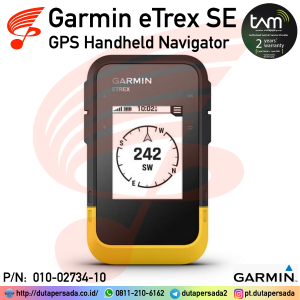
Garmin GPS eTrex SE – GPS Handheld Navigator
The Garmin eTrex SE is a rugged, entry-level handheld GPS designed for hiking, geocaching, and outdoor adventures, offering long battery life, multi-GNSS support, and wireless connectivity at an affordable price. It’s essentially the modern replacement for the older eTrex 10, but with upgraded features and usability.
SKU: 010-02734-10 -
Ready StockHandheld GPS
Garmin GPSMAP 86s – Marine Handheld Preloaded with Worldwide Basemap
The Garmin GPSMAP 86s is a rugged, floatable handheld GPS designed specifically for boating and sailing. With advanced marine features, wireless connectivity, and long battery life, it serves as both a reliable primary navigator and a dependable backup to your onboard electronics.
SKU: 010-02235-03 -
Pre-OrderHandheld GPS
Garmin GPSMAP H1 – Premium GPS Handheld Touchscreen
The Garmin GPSMAP H1 is a tough, reliable handheld GPS designed for outdoor recreation, trekking, and exploration. Built with advanced satellite support and long battery life, it ensures accurate navigation even in the most challenging environments.
SKU: 010-02920-13


There are no reviews yet.